
Owning fossil history with oral tradition and science
Before paleontologists began scouring indigenous lands for proof of evolution in the fossil record, Native Americans had long since incorporated these “new discoveries” into their cultures. Centuries before Europeans arrived, native inhabitants of the Americas understood that the land had once been teeming with massive creatures that ruled the earth, water and sky.
Depiction of the American mastodon.
Before paleontologists began scouring indigenous lands for proof of evolution in the fossil record, Native Americans had long since incorporated these “new discoveries” into their cultures. Centuries before Europeans arrived, native inhabitants of the Americas understood that the land had once been teeming with massive creatures that ruled the earth, water and sky. Their distant ancestors had lived alongside mammoths and mastodons, giant sloths, saber-toothed tigers, and giant bison—extinct animals that lived on in Native oral histories backed up by fossils.[1]
Native oral history
Some of these stories identified mastodons as the “grandfathers of the buffalo.” One such tale tells of a wounded warrior who has a vision of the Little People—spirits responsible for protecting humanity—sailing to a swamp, where they ambush a group of giant beasts as the animals rise up from the earth. When the warrior returns home, he shares his vision, inspiring his people to visit the site for themselves. There, they find the bones of the buffalo-like creatures killed by the Little People. That same swamp, now called Big Bone Lick State Historic Site, is where Abenaki guides discovered mastodon fossils in 1739.[2]
Native oral histories are consistent with fossil records. An Abenaki legend tells of Great Elk, a creature so huge that it made other animals seem like ants. It had an extremely tough hide and could walk through eight-foot snow drifts. Great Elk also had a peculiar ‘extra arm’ protruding from its upper body. Some scholars believe that such legends contain actual oral histories of the mastodons and mammoths hunted by Native ancestors.[3]
These oral histories are incredibly important in understanding fossils – a way of looking back in time to picture what it may have been like to live alongside long-extinct species. Early paleontologists used native oral histories to help locate and extract bones from fossil beds. Today, it’s still common to find fossil hunters and even paleontologists removing fossils from Native lands for study or for sale.
A resource under threat

A image of two Native Americans discovering a fossilized mastodon skeleton along a river, from Thomas Bewick’s A General History of Quadrupeds Public domain via Internet Archive
Dr. Lawrence Bradley, an adjunct professor in the Department of Geology and Geography at the University of Nebraska Omaha (a member of the Oglala Lakota Tribe) researched how fossil collectors have been taking specimens from tribal land since Western scientists discovered them in the United States in the mid-1800s. He began researching this topic after he got permission to Santee Sioux Reservation leaders to conduct a survey of what fossils they had on their land. He discovered that a plesiosaur specimen had recently been excavated from the reservation without the knowledge of the tribe. He then conducted surveys of museum and university fossil collections. Based on an educated guess from the museums he surveyed, Bradley said anywhere from 50 to 75 percent of the fossil specimens in those museums’ collections were from tribal land.[4]
Unfortunately, fossils are not covered under the Native American Graves Protection and Repatriation Act, that requires museums and other organizations to return Native American cultural items, including “human remains, funerary objects, sacred objects, and objects of cultural patrimony,” to descendants or tribes. Bradley said that even if dinosaur fossils were returned to their owners, few tribes have either a place to store or resources to manage them.
Standing Rock Sioux Tribe protects its fossils with law and technology
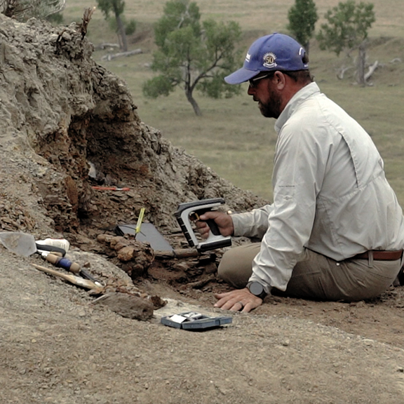
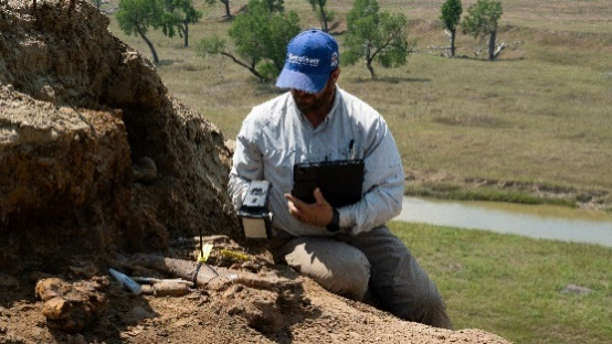
ESF founder Thomas Hebert tagging fossils at a dig owned by the Standing Rock Sioux Tribe.
The Standing Rock Sioux Tribe is the first in the nation to create its own paleontology code that sets out rules for fossil collection on its land, according to Benjamin M. Eagle, the fossil preparator for the Standing Rock Sioux Tribe. The code defines a fossil and says that the Standing Rock Sioux Tribe is the owner of all fossils found on its land, “no matter what,” said Eagle.[4]
It’s critical that fossils are protected, identified and tracked to protect Native cultural heritage and to secure and maintain fossil rights as they are excavated for study and display in museums. The Standing Rock Sioux Tribe has recently begun working with the Earth Sciences Foundation, Inc. (ESF) to excavate, identify, tag and manage fossils found on tribal land. This study describes how 347 fossils were excavated, tagged and uploaded into ArcGIS so that the data of fossils can be verified and updated at any time with a quick RFID scan. This GIS data can be shared with partners selected by the Sioux Tribe – from the ESF to university partners.
Tom Hebert, the founder of ESF, describes how the process works in this Esri blog. The tribe has more than 10,000 fossils that require cataloging and this work will continue over the next few years.
Sonya White Mountain, former director of the Standing Rock Institute of Natural History states: “We have so much here, so much that could make an impact if people would...not just come and take advantage and leave,” said White Mountain, “but come and help and invest themselves into us, into our culture, into our resources.”[4]
Footnotes:
[1] From a 2022 essay by Adrienne Mayor https://www.smithsonianmag.com/history/the-first-fossil-finders-in-north-america-were-enslaved-and-indigenous-people-180981615/

GIS Day - Mapping our past with the help of RFID
It’s Geographic Information Systems (GIS) Day! Since 1999 when it was first celebrated as the grand finale to Geography Week, GIS has been quickly put to use by many professions, industries and researchers. Today, GIS is becoming indispensable for paleontology - with the help of RFID.
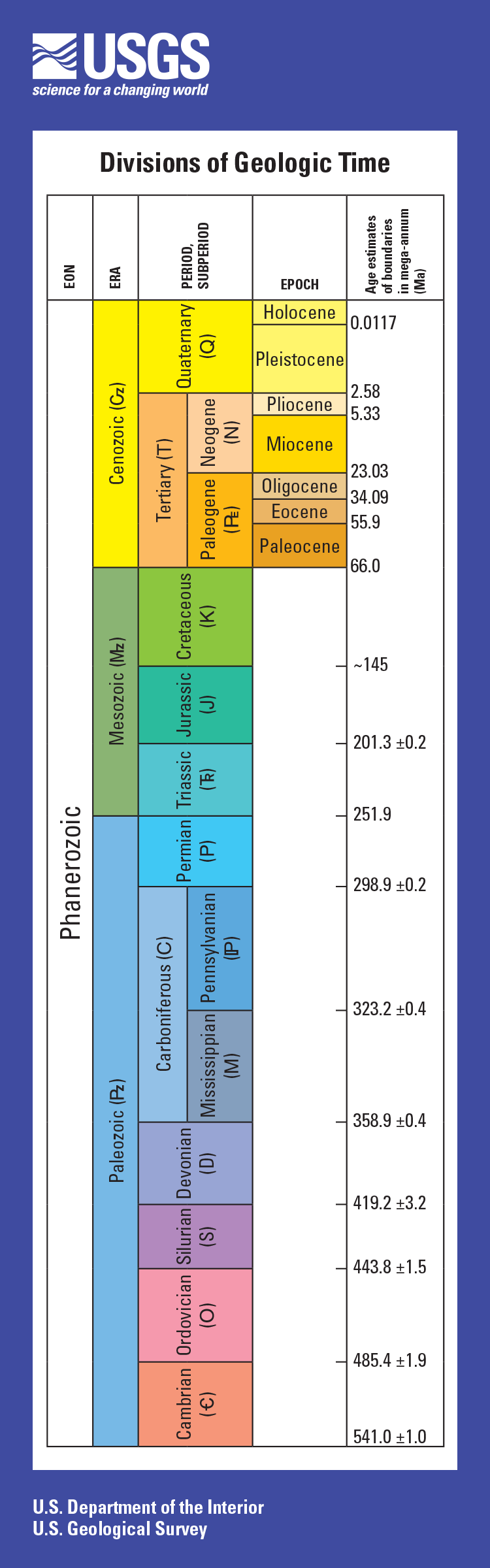
Ages shown for divisions of geologic time are general representations. Ages in mega-annum mean millions of years before present. Box heights are related to how long time periods lasted; different scaling factors are used for the column on the front of the bookmark and for the column on the back, which represents a much longer time period. Map symbols are in parentheses. For more specific age information, see U.S. Geological Survey Fact Sheet 2018–3054 (https://doi.org/10.3133/fs20183054).
It’s Geographic Information Systems (GIS) Day! Since 1999 when it was first celebrated as the grand finale to Geography Week, GIS has been quickly put to use by many professions, industries and researchers. Today, GIS is becoming indispensable for paleontology - with the help of RFID.
The Age of Dinosaurs
According to the United States Geological Survey (USGS), the 'Age of Dinosaurs' (the Mesozoic Era) included three consecutive geologic time periods (the Triassic, Jurassic, and Cretaceous Periods). Different dinosaur species lived during each of these three periods. For example, the Jurassic dinosaur Stegosaurus had already been extinct for approximately 80 million years before the appearance of the Cretaceous dinosaur Tyrannosaurus. In fact, the time separating Stegosaurus and Tyrannosaurus is greater than the time separating Tyrannosaurus and you.
At the beginning of dinosaur history (the Triassic Period), there was one supercontinent on Earth called Pangea. Many dinosaur types were spread across it. However, as Pangea broke apart, dinosaurs became scattered across the globe on separate continents, and new types of dinosaurs evolved separately in each geographic area (1).
When were fossils recognized as ancient dinosaur remains?
Fossils have probably been found throughout human history, despite not being recognized for what they are. Discoveries of their bones were often attributed to giant versions of known animals, or even giant people. Perhaps dinosaur bones inspired the stories of griffins, giants, and dragons.
Fossils of dinosaurs, described by a Chinese historian in the 4th century BCE, were labeled as dragon bones, while "dragon bones" were prescribed for ailments from madness to diarrhea. There’s no evidence as to the effectiveness of this treatment, however.
In 1822, Mary Ann Mantell was accompanying her husband, obstetrician, and paleontologist Gideon Mantell, on a visit to a patient in Sussex, England, when she noticed something at the side of the road. Looking closer, she found large teeth embedded into the rock.
Her husband Gideon realized that the fossil belonged to a creature unknown to science. He continued to study it and later named it Iguanadon after its iguana-like teeth. Later, paleontologist Richard Owen examined a number of fossil sets and concluded that Iguanodon, Megalosaurus, and Hylaeosaurus fossils were from "a distinct tribe or sub-order of Saurian Reptiles" which he termed, "dinosauria". (2)
Earth Science
Today, an entire field of science is dedicated to the study of the earth, aptly named Earth Science. It includes four branches of study, including geology, meterology, oceanography and astronomy. Geologists specializing in the earth’s history are palentologists, and this group studies fossils to gather evidence to piece together what the ancient past might have been like.

Norman Ross of the division of Paleontology, National Museum, preparing the skeleton of a baby dinosaur some seven or eight million years old for exhibition. , 1921.
It’s getting harder and harder to access places where fossils are plentiful and the Earth Sciences Foundation, Inc. (ESF) was founded to help locate and protect fossils before they disappear. The foundation’s goal is to get people excited about and involved in earth sciences. Fields of study include everything from paleontology, to GIS to surveying.
One of the biggest issues facing scientists is keeping track of fossils, both in the ground and after they have been shipped to museums or universities for study. Recent headlines attest to the difficulty museums face in keeping track of all of their artifacts. Fortunately, there is an elegant solution to this pervasive (and costly) problem.
Each fossil was identified with a unique RFID tag that connected it to its record in ArcGIS. Data about the fossil was added throughout the process - accessible to all stakeholders in real time.
Berntsen has been working with The Earth Sciences Foundation to leverage the power of RFID to use GIS to track and manage dinosaur bones. Our InfraMarker Connected RFID has the potential to revolutionize how these precious artifacts are tracked from the time they are excavated until they are put on display in museums or sent to universities across the world for study. A simple RFID tag connected to GIS will allow scientists to see all the data about any specific artifact, including where it was found, photographs, video, notes and any other information about it, simply by accessing GIS. The RFID tag will stay with each artifact throughout its academic journey, making both the information and the location accessible at any time.
Dig to Display: Transforming Dinosaur Bone Asset Management with InfraMarker RFID and GIS

View of bone fossil locations on a map, with the selected bone displaying its data.
A recently-published study describes how dinosaur bones at Standing Rock Sioux lands in South Dakota were tracked from dig to display. ESF staffers used ArcGIS, Survey123 and InfraMarker RFID to track 347 artifacts from excavation to storage to display.
The bone tracking and management process is simple. Each discovered fossil was ‘tagged’ in the field with a tiny HID RFID marker to establish a unique digital and physical ID. That ID, and contemporaneous information, was captured by a field tech using a tablet with data collection software connected to a GIS platform. RFID scans of the bone’s tag tracked the bone as it moved through various zones from field to storage to cleaning to display, adding data to its GIS record. Simultaneously, hundreds of miles from the dig site, the contractor’s GIS platform displayed a map of original and current bone location and status as it moved from field to institute. Throughout the process, all RFID interrogation data was collected in the cloud, providing near real-time visibility of bone status by auditors hundreds of miles from the dig site.

One of the RFID tags used in the study.
Saves time; near perfect accuracy
Study results found a reduction of field data collection time by 80 percent, nearly perfect tracking of bones through the cycle from field to museum, and enabled easy data sharing and auditing of field work by related organizations.
The study demonstrated the benefits of the RFID/GIS integration that are making a huge difference in many industries - from utility management to agriculture, forestry and manufacturing. Another recent study shows how RFID can help identify and verify underground utilities, streamlining utility management and enhancing safety.
RFID and GIS - Accuracy, versatility and power
RFID and GIS expanding the benefits of location intelligence to new applications and streamlining access to valuable assets - from buried utilities to museum artifacts. Sales of RFID and GIS are exponentially growing because of the tremendous advantages these technologies offer across industries. When RFID is integrated with GIS through InfraMarker, accurate asset management is enabled by connecting the physical asset to its digital files that can be quickly accessed on-site with a simple RFID scan (or even a NFC scan from a cell phone). RFID provides asset authentication at the site of any asset, streamlining field work and improving accuracy and automatically generating tracking information. Any organization that needs to track and manage assets across space and time will benefit from incorporating InfraMarker RFID with their GIS.